
ADAS, or advanced driver assistance systems, are already standard in many vehicles on the market. Adaptive cruise control, lane drift warning, and blind-spot warnings have ushered in the next generation of safe driving experiences. Consumers who embrace technology expect high-performance ADAS systems in their vehicles.
The whole automobile sector is anticipating self-driving vehicles and assistance technologies. Automotive companies are developing new and affordable sensors to enable novel technology in Advanced Driver Assistance Systems. ADAS systems cannot rely just on vision and RADAR-based technologies to provide comprehensive vehicle safety solutions; they need more efficient systems capable of giving highly precise data for increased driver assistance.
This is where LIDAR comes in. In this blog, we will discuss what it is, how it works, and how it supplements the already high-functioning ADAS technology.
Advanced Video Telematics Solutions at Ridiculously Accessible Prices!
What is LIDAR?
LiDAR stands for light detection and ranging. It measures several factors along its path using a pulsed laser. It also aids in mapping the environment. A typical LiDAR-based autonomous machine system comprises the following components:
- Eye-Safe Laser Sources: widely employed in automobile applications.
- Scanning Mechanism: The scanning mechanism determines the ability of a LiDAR system to accurately map its surroundings. This offers critical information about the object’s azimuth and elevation.
- GPS and Inertia Measuring Unit: This offers information about the autonomous vehicle’s position as well as sensor orientation.
- Computer: With such a large volume of data, each pulse must be processed in order to obtain the specific azimuth and elevation levels of the objects being mapped.
How Does LIDAR Work?
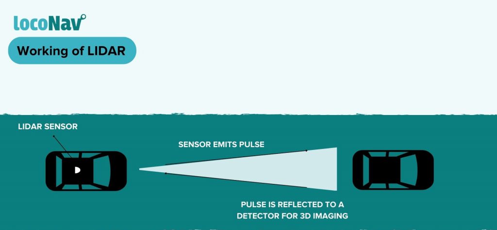
Autonomous vehicles frequently have a dome-shaped device revolving on top of the vehicle. This dome is the LIDAR sensor that uses laser pulses to measure different parameters of the vehicle. The pulse is emitted on a surface which is reflected. The reflected pulse is processed to locate objects in the path of the vehicle.
A standard system fires millions of pulses per second. One of the essential criteria to consider before using reflected pulse data that contains the sensor in order to obtain an accurate mapping estimate. In general, LiDAR detection is divided into two categories: coherent and incoherent.
- Coherent detection – The scanning device that collects the pulses after reflection determines azimuth and elevation using ToF (Time of flight).
- Incoherent detection – To calculate azimuth and elevation, the scanning device compares the received and sent pulses.
Each reflected pulse, regardless of the detecting method, is processed for 3D object detection using a point cloud.

Types of LIDAR Sensors
- Solid State LIDAR
- Are totally built on a single chip.
- Are small in size since they are built on microchips.
- Use optical emitters to send a flash of laser photons without needing to alter the transmitters’ direction.
- Because it is highly durable, dependable, inexpensive, and commercially feasible, solid-state LIDAR is the foundation of LIDAR-based ADAS systems.
- Electro-Mechanical LIDAR
- Can be thought of as the first-gen ADAS sensors for automotive industries.
- These mechanical rotating LIDAR system sensors are made up of numerous moving elements that are arranged to generate and output an assortment of laser beams towards the target point.
- Electromechanical LIDARs are large, expensive, and prone to wear and tear in difficult terrain.
- They are mounted on the vehicle’s roof and continually spin to scan the vehicle’s surroundings, generally covering a large area.
How Does LIDAR Supplement ADAS?
The automotive industry must rely on all three types of ADAS sensors, namely vision, RADAR, and LIADR-based sensors, for levels 4 and 5 of vehicle automation. All three sensor units work together to provide total driver assistance.
Whereas vision-based systems help in high visibility situations by assisting with parking, detecting traffic signs, identifying road markings, and more, RADAR-based systems function in low visibility conditions by covering a significantly longer range.
LIDAR-based systems are particularly accurate in detecting and recognising objects of 3D forms over greater distances when sensing the vehicle’s surroundings with a 360-degree field of view (100-200 meters). The 3D mapping capacity of a LIDAR system also aids in distinguishing between cars, pedestrians, trees, persons, and other objects, as well as calculating and communicating specifics of their velocity in real-time.
